


Too early to tell extent of 2024's inversion layer: Meteorologist
As the weather cools and the sun changes its position in the sky, Wānaka and Cromwell residents prepare themselves for days of looking up and only seeing the cloudy inversion layer above.
And, whenever there's an inversion layer hovering over Central Otago, Tarras Country Cafe owner Antonia Wilson says her business sees a lot more people coming through from the surrounding areas just to see the sun.
While last year saw an inversion layer hanging over Wānaka and Cromwell for a few weeks, Ms Wilson says in Tarras the fog generally only stays around for two days a year at most.

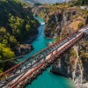
The inversion layer spotted over Gibbston on the Crown Range Road.
MetService meteorologist Clare O'Connor says Wānaka and Cromwell bear the brunt of it because of Lakes Wānaka and Dunstan.
"The main thing you need is moisture and the cooler temperatures, and with those lakes there, that's what really drives it."
Ms O'Connor used to live in Lake Tekapo and says areas in the Mackenzie Basin would also experience the inversion layer hanging overhead.
"The inversion means that you've got the temperature above that cloud layer is actually warmer than what it is below, so you need that warm air to mix in and break it up and burn off that cloud."
However, she says, it's tricker for this process to occur in winter, because the sun is positioned at a lower angle, and the days are shorter, so the sun isn't around for as long.
"So you don't get that mixing, so it's much harder for the cloud to move on, and oftentimes it will only really move on once you get a wind blowing through - like those westerly winds on the West Coast."
She explains a lower angle of the sun means its light isn't as powerful either.
"Have you ever shot a torch on a piece of paper? If you shot it straight down, it's more focussed, whereas if you shot it at more of an angle, the beam of light is more stretched out."
But why isn't there one in Queenstown, when it's also got Lake Wakatipu sitting there?
She says the airflow is different in Queenstown, and it's able to flow south, travelling down via Kingston.
The team at MetService often sees this occur on satellite imagery, and observed this phenomenon occurring today, she says.
"Whereas Wānaka and Cromwell, they aren't as quite exposed to the south, so that probably prohibits that drainage."
She explains that the inversion layer was prevalent last year because there was a high-pressure system over the South Island, keeping the sky clear and light, and wind level low.
"It keeps everything squashed."
She says it's too early to tell what the inversion will be like this year.
So, how does an inversion layer leave people who use the sun for production, like cherry grower Mike Casey, who uses solar power to fuel his business, and also his home?
"The answer is that it [the inversion layer] definitely affects your production, but it doesn't seem to affect it nearly as much as people think it does," Mr Casey says.
The orchard's solar usage and energy usage are timed well with the less sunny months, because there's far less work to be done on the farm over winter.
However, Mr Casey says his orchard is half powered by solar, and half, by the grid, so it's more about "cost savings" rather than being a replacement.
In his home, though, he says he's got a battery that allows his family to save energy too, and solar panels covering the entire roof of his house.
"With solar panels being as cheap as they are, if you're building a solar system in our region, you should be designing that and building that system to cater for the inversion layer."
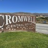
Main image: The inversion fog in Cromwell, June 23, 2023.
![]()


TOP STORIES